

Software and Data

The CoastWatch Utilities
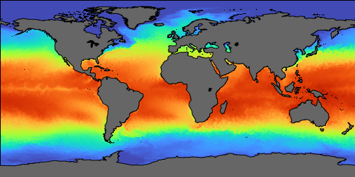
CoastWatch is a US National Oceanic and Atmospheric Administration (NOAA) program that provides global coverage oceanographic satellite imagery in near-real time (within several hours of data capture) using data from weather and research satellites. The CoastWatch Utilities software is designed for analyzing, converting, and viewing data files distributed by CoastWatch and others.
Latest release: coastwatch.noaa.gov
Past and beta releases: s3://terrenus-storage/cwutils
YouTube tutorial videos: youtube.com
Project source code: github.com/phollemans/cwutils
CoastWatch Data
The CoastWatch Utilities read CoastWatch HDF, NetCDF with CF metadata, NOAA 1b AVHRR, and GRIB data. CoastWatch distributes HDF and NetCDF files, and also provides data over a THREDDS and ERDDAP server connection for analysis packages. It operates these services from a central node and several regional nodes:
CoastWatch products and NOAA 1b data is also available retrospectively from the NOAA CLASS Archive.
Terrenus HRPT Ingestor
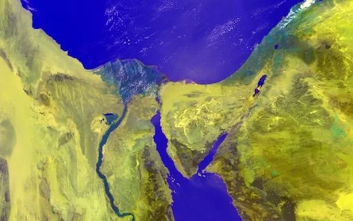
The Terrenus High Resolution Picture Transmission (HRPT) ingestor software is used for processing level 0 HRPT/CHRPT captured at a receiving station. The software extracts the Advanced Very High Resolution Radiometer (AVHRR) or Multichannel Visible and Infrared Scan Radiometer (MVISR) sensor data, performs thermal channel calibration, computes earth locations and scan angles, and writes an HDF or NetCDF file. The output may be used with the CoastWatch Utilities, or with third-party software such as IDL, Matlab, or Python to compute level 2 products. The package is released under the GNU General Public License with full source code:
hrpt_2_2_linux.tar.gz (4 Mb)
hrpt_2_2_macosx.dmg (5 Mb)
hrpt_2_2_win32.exe (4.9 Mb)
The HRPT User Manual describes how to install and use the software, and the Sample Images page show examples of the software output rendered using the CoastWatch Utilities. Version 2.2 contains the following improvements:
Corrected errors in satellite earth location during the month of March in leap year (2008, 2012, ...)
Corrected erroneously flagged missing lines in the output of NOAA-18 data
Added support for TeraScan CHRPT format ingest from FY-1D
Corrected missing line data values in NetCDF output files
See the user manual for all the changes.
Acknowledgements: The software development and installation packages for the Terrenus HRPT Ingestor were made possible by the generous donation of licenses for JProfiler and install4j by ej-technologies.
HRPT Data
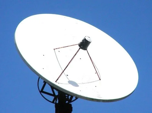
High Resolution Picture Transmission (HRPT) is a data format used by weather satellites to transmit digital data back to the earth. NOAA HRPT data format is fully documented in the NOAA Polar Orbiter Data Users Guide and the NOAA KLM Users Guide. HRPT data is available from the NOAA CLASS Archive and from individual data capture station archives. You can also acquire HRPT data with a receiver from companies such as Dartcom and SeaSpace.